Butser Hill: Tuesday 22 September 2026 to Thursday 24 September 2026
Morning valley fog may recur on these dates. Separate daily possibilities, not continuous fog. Check the timing and confidence for each date.
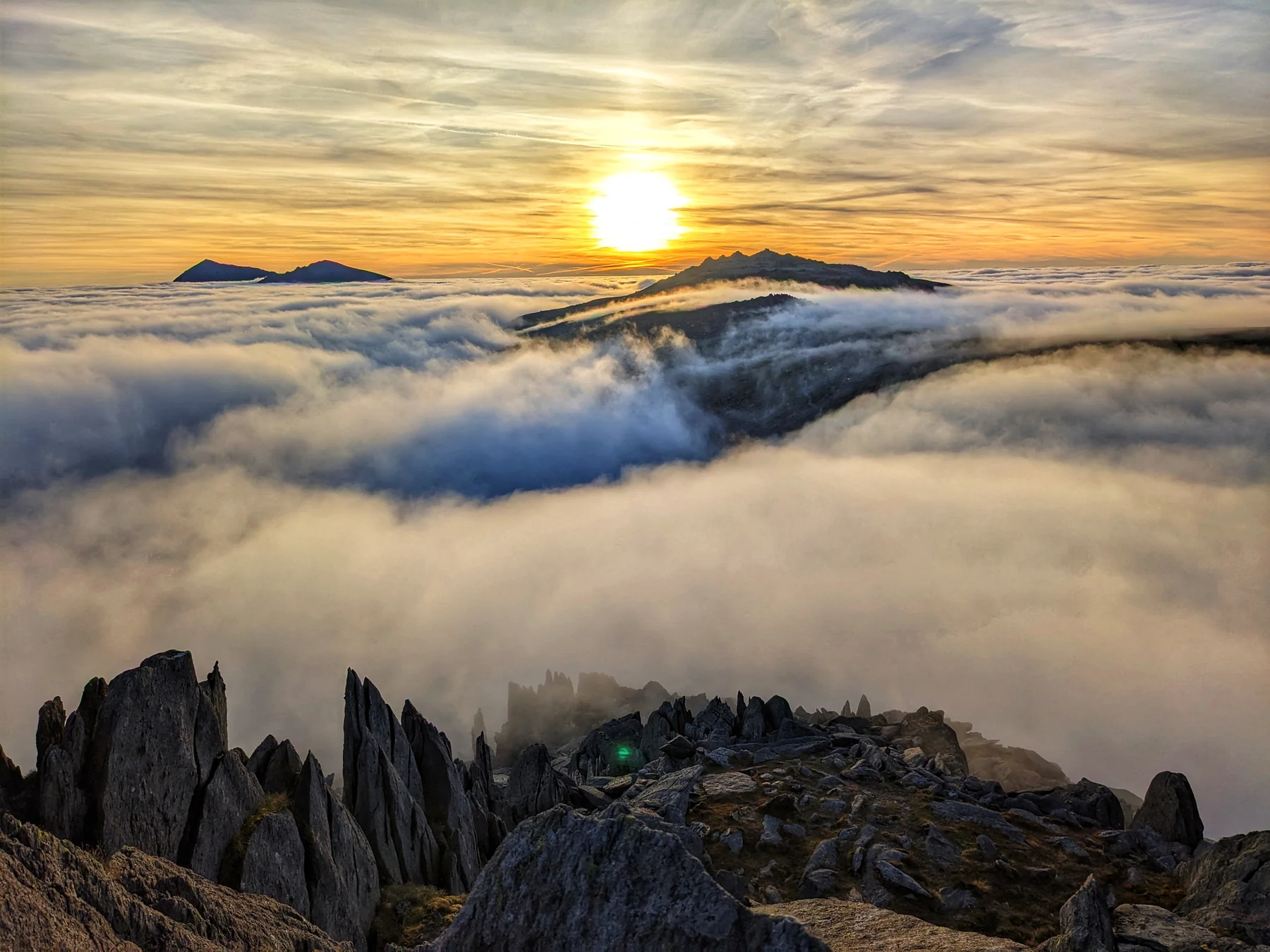
Possible cloud seas and early valley mist. Check the timing and uncertainty before planning a trip for the view.
Morning valley fog may recur on these dates. Separate daily possibilities, not continuous fog. Check the timing and confidence for each date.
Morning valley fog may recur on these dates. Separate daily possibilities, not continuous fog. Check the timing and confidence for each date.
Morning valley fog may recur on these dates. Separate daily possibilities, not continuous fog. Check the timing and confidence for each date.
These peaks may stand above a bounded layer of lower cloud. They are possibilities, not promises. Check the timing, confidence and cloud height.
Some peaks or dates could not be assessed. An unlisted peak may still have an inversion.
A cloud sea is possible during the morning, with its estimated top around 700-1000 m. The cloud top is close to summit height. The summit could remain in cloud, but a lower cloud top could allow it to emerge. Higher cloud may limit sunshine. Times are approximate model indications, not predicted fog burn-off times.
A cloud sea is possible during the morning, with its estimated top around 900-1200 m. The cloud top is close to summit height. The summit could remain in cloud, but a lower cloud top could allow it to emerge. This does not guarantee sunshine. Times are approximate model indications, not predicted fog burn-off times.
A cloud sea is possible during the morning, with its estimated top around 900-1200 m. The cloud top is close to summit height. The summit could remain in cloud, but a lower cloud top could allow it to emerge. This does not guarantee sunshine. Times are approximate model indications, not predicted fog burn-off times.
A cloud sea is possible during the morning, with its estimated top around 600-1000 m. The cloud top is close to summit height. The summit could remain in cloud, but a lower cloud top could allow it to emerge. This does not guarantee sunshine. Times are approximate model indications, not predicted fog burn-off times.
A cloud sea is possible early in the morning, with its estimated top around 800-1100 m. The cloud top is close to summit height. The summit could remain in cloud, but a lower cloud top could allow it to emerge. This does not guarantee sunshine. Times are approximate model indications, not predicted fog burn-off times.
A cloud sea is possible during the morning, with its estimated top around 800-1100 m. The cloud top is close to summit height. The summit could remain in cloud, but a lower cloud top could allow it to emerge. This does not guarantee sunshine. Times are approximate model indications, not predicted fog burn-off times.
A cloud sea is possible during the morning, with its estimated top around 700-1100 m. The cloud top is close to summit height. The summit could remain in cloud, but a lower cloud top could allow it to emerge. This does not guarantee sunshine. Times are approximate model indications, not predicted fog burn-off times.
A cloud sea is possible early in the morning, with its estimated top around 600-900 m. The cloud top is close to summit height. The summit could remain in cloud, but a lower cloud top could allow it to emerge. This does not guarantee sunshine. Times are approximate model indications, not predicted fog burn-off times.
A cloud sea is possible during the morning, with its estimated top around 600-1000 m. The cloud top is close to summit height. The summit could remain in cloud, but a lower cloud top could allow it to emerge. This does not guarantee sunshine. Times are approximate model indications, not predicted fog burn-off times.
A cloud sea is possible during the morning, with its estimated top around 600-1000 m. The cloud top is close to summit height. The summit could remain in cloud, but a lower cloud top could allow it to emerge. This does not guarantee sunshine. Times are approximate model indications, not predicted fog burn-off times.
A cloud sea is possible during the morning, with its estimated top around 600-1000 m. The cloud top is close to summit height. The summit could remain in cloud, but a lower cloud top could allow it to emerge. This does not guarantee sunshine. Times are approximate model indications, not predicted fog burn-off times.
A cloud sea is possible during the morning, with its estimated top around 900-1200 m. The cloud top is close to summit height. The summit could remain in cloud, but a lower cloud top could allow it to emerge. This does not guarantee sunshine. Times are approximate model indications, not predicted fog burn-off times.
A cloud sea is possible during the morning, with its estimated top around 700-1000 m. The cloud top is close to summit height. The summit could remain in cloud, but a lower cloud top could allow it to emerge. This does not guarantee sunshine. Times are approximate model indications, not predicted fog burn-off times.
A cloud sea is possible during the morning, with its estimated top around 700-1000 m. The cloud top is close to summit height. The summit could remain in cloud, but a lower cloud top could allow it to emerge. This does not guarantee sunshine. Times are approximate model indications, not predicted fog burn-off times.
A cloud sea is possible during the morning, with its estimated top around 600-1000 m. The cloud top is close to summit height. The summit could remain in cloud, but a lower cloud top could allow it to emerge. This does not guarantee sunshine. Times are approximate model indications, not predicted fog burn-off times.
A cloud sea is possible during the morning, with its estimated top around 900-1200 m. The cloud top is close to summit height. The summit could remain in cloud, but a lower cloud top could allow it to emerge. This does not guarantee sunshine. Times are approximate model indications, not predicted fog burn-off times.
A cloud sea is possible during the morning, with its estimated top around 800-1100 m. The cloud top is close to summit height. The summit could remain in cloud, but a lower cloud top could allow it to emerge. This does not guarantee sunshine. Times are approximate model indications, not predicted fog burn-off times.
A cloud sea is possible early in the morning, with its estimated top around 600-900 m. The cloud top is close to summit height. The summit could remain in cloud, but a lower cloud top could allow it to emerge. This does not guarantee sunshine. Times are approximate model indications, not predicted fog burn-off times.
A cloud sea is possible during the morning, with its estimated top around 600-900 m. The cloud top is close to summit height. The summit could remain in cloud, but a lower cloud top could allow it to emerge. This does not guarantee sunshine. Times are approximate model indications, not predicted fog burn-off times.
A cloud sea is possible during the morning, with its estimated top around 700-1100 m. The cloud top is close to summit height. The summit could remain in cloud, but a lower cloud top could allow it to emerge. This does not guarantee sunshine. Times are approximate model indications, not predicted fog burn-off times.
A cloud sea is possible early in the morning, with its estimated top around 800-1100 m. The cloud top is close to summit height. The summit could remain in cloud, but a lower cloud top could allow it to emerge. This does not guarantee sunshine. Times are approximate model indications, not predicted fog burn-off times.
A cloud sea is possible during the morning, with its estimated top around 600-900 m. The cloud top is close to summit height. The summit could remain in cloud, but a lower cloud top could allow it to emerge. This does not guarantee sunshine. Times are approximate model indications, not predicted fog burn-off times.
A cloud sea is possible early in the morning, with its estimated top around 600-900 m. The cloud top is close to summit height. The summit could remain in cloud, but a lower cloud top could allow it to emerge. This does not guarantee sunshine. Times are approximate model indications, not predicted fog burn-off times.
A cloud sea is possible early in the morning, with its estimated top around 600-900 m. The cloud top is close to summit height. The summit could remain in cloud, but a lower cloud top could allow it to emerge. This does not guarantee sunshine. Times are approximate model indications, not predicted fog burn-off times.
Light winds and overnight cooling may leave mist in sheltered valleys, sometimes with clearer hills above. These broad local-weather signals do not establish fog depth or guarantee clear summits.
Early morning. Patchy mist is possible in sheltered valleys early on. Clearer hilltops above the mist are possible, but this signal does not establish fog depth or clear summits.
Light winds, moist air and relatively clear skies early in the morning favour local cooling.
Early morning. Patchy mist is possible in sheltered valleys early on. Clearer hilltops above the mist are possible, but this signal does not establish fog depth or clear summits.
Light winds, moist air and relatively clear skies early in the morning favour local cooling.
Early morning. Patchy mist is possible in sheltered valleys early on. Clearer hilltops above the mist are possible, but this signal does not establish fog depth or clear summits.
Light winds, moist air and relatively clear skies early in the morning favour local cooling.
Early morning. Patchy mist is possible in sheltered valleys early on. Clearer hilltops above the mist are possible, but this signal does not establish fog depth or clear summits.
Light winds, moist air and relatively clear skies early in the morning favour local cooling.
Early morning. Patchy mist is possible in sheltered valleys early on. Clearer hilltops above the mist are possible, but this signal does not establish fog depth or clear summits.
Light winds, moist air and relatively clear skies early in the morning favour local cooling.
Early morning. Patchy mist is possible in sheltered valleys early on. Clearer hilltops above the mist are possible, but this signal does not establish fog depth or clear summits.
Light winds, moist air and relatively clear skies early in the morning favour local cooling.
Early morning. Patchy mist is possible in sheltered valleys early on. Clearer hilltops above the mist are possible, but this signal does not establish fog depth or clear summits.
Light winds, moist air and relatively clear skies early in the morning favour local cooling.
Early morning. Patchy mist is possible in sheltered valleys early on. Clearer hilltops above the mist are possible, but this signal does not establish fog depth or clear summits.
Light winds, moist air and relatively clear skies early in the morning favour local cooling.
Early morning. Patchy mist is possible in sheltered valleys early on. Clearer hilltops above the mist are possible, but this signal does not establish fog depth or clear summits.
Light winds, moist air and relatively clear skies early in the morning favour local cooling.
Early morning. Patchy mist is possible in sheltered valleys early on. Clearer hilltops above the mist are possible, but this signal does not establish fog depth or clear summits.
Light winds, moist air and relatively clear skies early in the morning favour local cooling.
Early morning. Patchy mist is possible in sheltered valleys early on. Clearer hilltops above the mist are possible, but this signal does not establish fog depth or clear summits.
Light winds, moist air and relatively clear skies early in the morning favour local cooling.
Early morning. Patchy mist is possible in sheltered valleys early on. Clearer hilltops above the mist are possible, but this signal does not establish fog depth or clear summits.
Light winds, moist air and relatively clear skies early in the morning favour local cooling.
Early morning. Patchy mist is possible in sheltered valleys early on. Clearer hilltops above the mist are possible, but this signal does not establish fog depth or clear summits.
Light winds, moist air and relatively clear skies early in the morning favour local cooling.
Early morning. Patchy mist is possible in sheltered valleys early on. Clearer hilltops above the mist are possible, but this signal does not establish fog depth or clear summits.
Light winds, moist air and relatively clear skies early in the morning favour local cooling.
Early morning. Patchy mist is possible in sheltered valleys early on. Clearer hilltops above the mist are possible, but this signal does not establish fog depth or clear summits.
Light winds, moist air and relatively clear skies early in the morning favour local cooling.
Early morning. Patchy mist is possible in sheltered valleys early on. Clearer hilltops above the mist are possible, but this signal does not establish fog depth or clear summits.
Light winds, moist air and relatively clear skies early in the morning favour local cooling.
Early morning. Patchy mist is possible in sheltered valleys early on. Clearer hilltops above the mist are possible, but this signal does not establish fog depth or clear summits.
Light winds, moist air and relatively clear skies early in the morning favour local cooling.
Early morning. Patchy mist is possible in sheltered valleys early on. Clearer hilltops above the mist are possible, but this signal does not establish fog depth or clear summits.
Light winds, moist air and relatively clear skies early in the morning favour local cooling.
Early morning. Patchy mist is possible in sheltered valleys early on. Clearer hilltops above the mist are possible, but this signal does not establish fog depth or clear summits.
Light winds, moist air and relatively clear skies early in the morning favour local cooling.
Early morning. Patchy mist is possible in sheltered valleys early on. Clearer hilltops above the mist are possible, but this signal does not establish fog depth or clear summits.
Light winds, moist air and relatively clear skies early in the morning favour local cooling.
Early morning. Patchy mist is possible in sheltered valleys early on. Clearer hilltops above the mist are possible, but this signal does not establish fog depth or clear summits.
Light winds, moist air and relatively clear skies early in the morning favour local cooling.
Early morning. Patchy mist is possible in sheltered valleys early on. Clearer hilltops above the mist are possible, but this signal does not establish fog depth or clear summits.
Light winds, moist air and relatively clear skies early in the morning favour local cooling.
Early morning. Patchy mist is possible in sheltered valleys early on. Clearer hilltops above the mist are possible, but this signal does not establish fog depth or clear summits.
Light winds, moist air and relatively clear skies early in the morning favour local cooling.
Early morning. Patchy mist is possible in sheltered valleys early on. Clearer hilltops above the mist are possible, but this signal does not establish fog depth or clear summits.
Light winds, moist air and relatively clear skies early in the morning favour local cooling.
Weather data: Open-Meteo (CC BY 4.0). Adapted by Mountain Weather.
Mountain Weather for iPhone and Android
Choose a peak, set a watch for a possible inversion and get an alert when the forecast meets your chosen signal strength. Keep an eye on opportunities without checking the website every day.
An alert is a reason to check the latest timing and cloud heights, not a guarantee of clear tops. Enable notifications for your watch in the app.
Normally, air becomes colder with height. During a temperature inversion, a layer of warmer air sits above cooler air near the ground. Moisture can become trapped below that warmer layer, filling valleys and glens with cloud while higher summits remain clear.
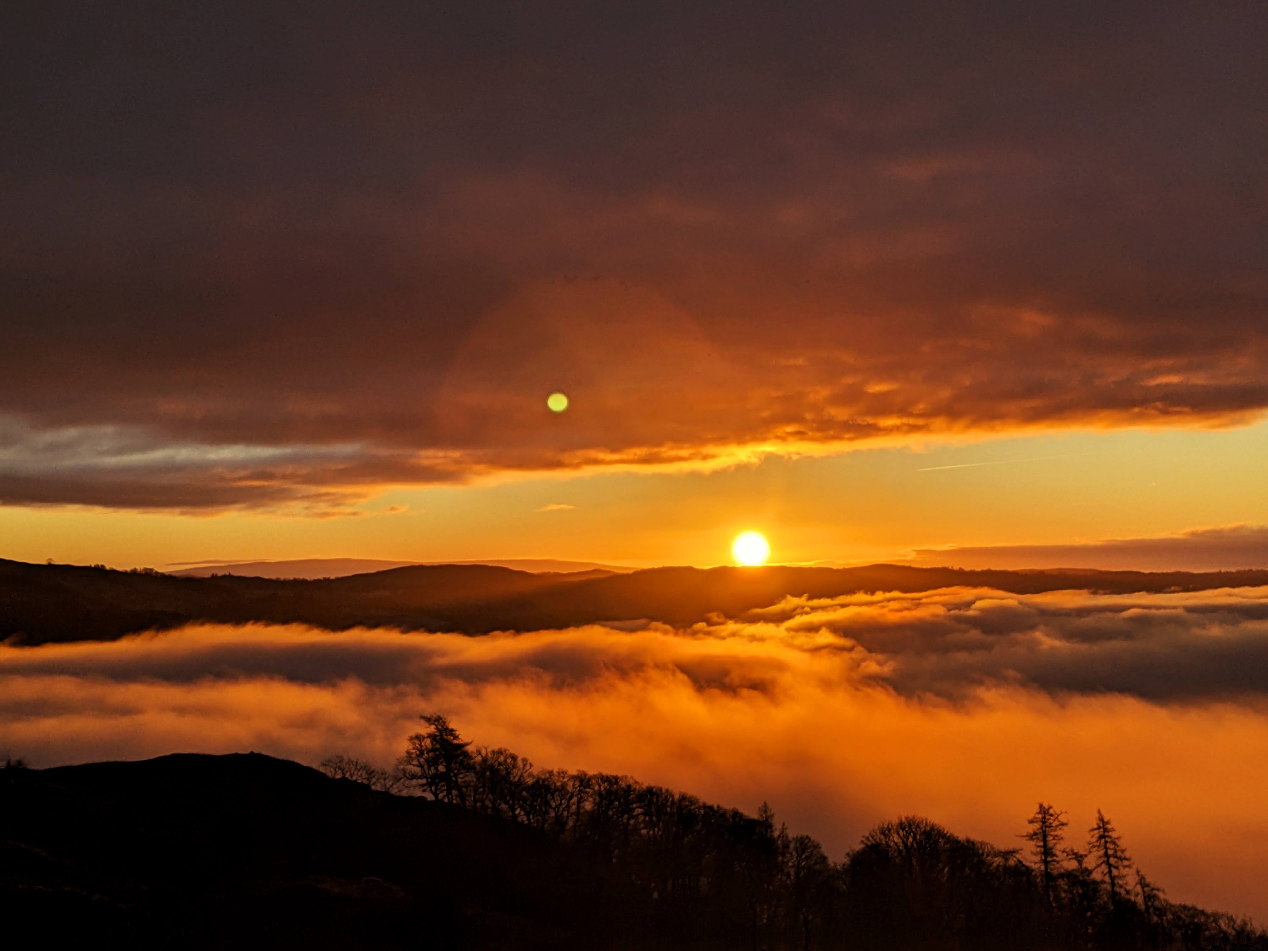
Look for settled high pressure, light winds and long clear nights, especially in autumn and winter. Cold air drains into valleys overnight, while drier air above may remain warmer. A strong inversion can persist well into the day; a weak one may break as sunshine warms the ground or wind increases.
Possible timing describes when the model indicates a bounded cloud layer below the summit. Separate spells are listed separately. Times are approximate, not predictions of exactly when fog will form or clear. Cloud top estimates the upper boundary of that lower layer; higher cloud may still limit sunshine. “Unavailable” means the current height cannot be assessed. An earlier signal retained is a cautious watch based on a previous run or a neighbouring forecast date, not a newly confirmed inversion. Confidence bands describe limitations in the evidence, not measured probabilities.
Our Snowdon and Tryfan cloud-base observations use webcam views and terrain heights to estimate where cloud meets the slopes. Check the observation time and compare it with the forecast for that mountain.
Cloud base is the lower edge, not the cloud top. These observations alone cannot confirm an inversion or tell you that the summit is above the whole cloud layer. They are provisional, camera-facing estimates, with gaps when the view cannot be assessed.
Cloud heights are uncertain. A summit near the estimated top can still be worth watching, even when the central forecast leaves it in cloud. We include borderline candidates with an estimated top up to 300 m above the summit, labelled low confidence. That allowance is provisional, not a measured error range. The summit may stay in cloud throughout.
A cloud base near the summit is not enough on its own: the layer could extend much higher. Valley-fog possibilities are listed separately when the weather favours early mist but its depth cannot be established. Consecutive dates describe recurring opportunities, not a promise of uninterrupted cloud below the hills.
The summit view is only part of the day. Navigation can be difficult in dense cloud below an inversion, and cold damp air can make lower slopes feel raw. Carry the kit and navigation skills for the least photogenic part of the route, not just the hoped-for view.