The day on the hill
On Thack Moor: summit wind broadly 15-30 mph, with gusts 35-45 mph at times (strong winds). Cloud-height uncertainty could put the summit in or out of cloud.
Clear spells may be difficult to time.
Cloud & views
Cloud may hang lower on western slopes and lift somewhat on the eastern side, but local terrain can differ.
Rain & temperature
Little or no rain is forecast.
Forecast confidence
Cloud height remains uncertain, especially where it is close to summit level. Exposed tops may feel chilly in the wind.
A windproof layer will help, with an extra warm layer for stops. Buffeting may affect balance on exposed ground, particularly near ridges and edges.
Cloud-height uncertainty could put the summit in or out of cloud, even where forecasts agree on the wider cloud cover.
Cloud-free timing: Around 45% early, improving to around 95% later.
Sunshine context Model-grid estimate, not summit sunshine
The surrounding model grid indicates 4.8 h of sunshine. This is not a forecast of time in sunshine on the summit. Use the cloud and views outlook above for the conditions on this mountain.
- Early
- 0 h
- Midday
- 1.9 h
- Later
- 1 h
Overnight forecast: 17:00–08:00 (UK local time), in Wild camping below.
Overnight · 17:00–08:00Wild campingBetaLower pitches look more comfortable than exposed ground near 600 m. 59/100Mixed · 600 m View detailsHide details

Full overnight outlook
Open-hillside camping looks mixed overall around 600 m (59/100). A lower pitch near 300 m looks more comfortable. Conditions are less suitable by 600 m. It may be breezy on open ground, with gusts near 25 mph. Little overnight rain is forecast. Some condensation is possible overnight.
Moon overnight
Waxing gibbous moon
- Illuminated disc
- 70%
- Moonrise
- 17:23 BST
- Moonset
- 23:56 BST
Views of the Moon may come and go through cloud breaks. Illumination describes the sunlit part of the Moon, not brightness at your pitch.
Overnight window: 20 Sep, 17:00 BST to 21 Sep, 08:00 BST. Approximate open-horizon times; hills can hide the Moon. Still take a headtorch.
Elevation reference (open ground)
- Wind / gust
- 13 mph / 23 mph
- Typical / low
- 7.5°C / 6.1°C · much of the night
- In cloud
- 0% of modelled night
- Condensation
- Moderate
- Wind / gust
- 15 mph / 27 mph
- Typical / low
- 7.5°C / 6.1°C · much of the night
- In cloud
- 0% of modelled night
- Condensation
- Low
Warmth planning: As a broad starting point, consider a 3-season bag with an ISO/EN comfort rating at or below about 4°C. Allow more margin if you sleep cold or expect fatigue, and use an adequate insulated mat. Dampness is possible, so keep the sleep system dry and ensure its insulation remains effective if damp.
Open-hillside reference. A sheltered pitch may be calmer; cols and ridges may be much windier. Tent design and the exact pitch still matter. Read about sleeping-bag comfort ratings, pitching in strong winds or using the wild-camping forecast.
Did this match your night?Share a quick observation to help improve this beta forecast.Give feedback
Daytime · exposed rockClimbing & scramblingBetaGusts near 35 mph may affect balance on exposed rock. Good77/100 View detailsHide details
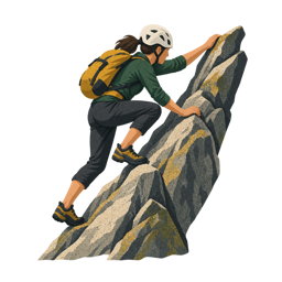
Full climbing & scrambling outlook
Conditions for exposed scrambling look good (77/100). Rock is likely to be mostly dry, though seepage and shaded holds are not resolved. The mapped summit rock is Sandstone (Stainmore Formation). Usually rough and grippy when dry. Damp sandstone and gritstone can feel greasy, and saturated sandstone may be weakened, so let the rock dry fully. Gusts may reach about 35 mph. Crosswinds can make exposed ridges substantially more serious.
Often grippy when dry, but wet sandstone can lose strength and may be damaged by climbing. Avoid it while saturated and allow shaded walls, pockets and seepage lines time to dry. Summit-point bedrock mapping; the actual route may cross different rock, superficial deposits, polish, lichen or seepage.
Generic exposed scrambling terrain; mapped summit-point bedrock is included where available, but route grade, exact rock, polish, drainage and escape options remain unresolved. Contains British Geological Survey materials © UKRI 2026. How to use the climbing and scrambling forecast.
Did this match your experience?Tell us about the rock surface and wind to help improve this beta forecast.Give feedback
Overnight · Aurora, stars & meteorsAfter darkBetaNight-sky guidance is unavailable for this night. View forecastClose forecast

After dark: aurora and stargazing
Night-sky guidance is unavailable for this night. This does not mean clear skies or no aurora.
Recommended kit for this dayWeather-aware packing prompts, plus your core hillwalking kitView kit
For a day hillwalk, not a complete route-specific checklist. Carry navigation and backup you can use, warm and waterproof layers, suitable footwear, food and water, a headtorch, emergency shelter, first aid and a way to call for help. Snow, ice, technical terrain and overnight trips need additional equipment and skills.
Does the weather shape your plans?Optional hill-user research. One answer helps; further questions are up to you.Take part
Help the Mountain Decisions Project understand how forecasts influence hill days, including when plans stay the same. Findings will be shared publicly as summaries, not individual responses.
This is about Thack Moor on Sunday 20 September 2026. It asks about intentions, not whether you actually went out. No name or account is needed.
Open the questions to take part.
About the research and your privacy · Already been out? Share that experience instead