Cloud base, seen from the hills
Webcam observations for Snowdon and Tryfan. See where cloud meets the slopes, then explore the readings behind the view.

Camera image unavailable. Visit the camera provider.
Camera: University of London Graduate Mountaineering Club (ULGMC), Caseg Fraith Hut. Used with permission.
Latest observation
Above visible topsProvisional webcam estimate, above sea level. The camera-facing slopes, not the whole mountain.
Useful context for the view now, not a promise that cloud will stay at this height. Compare it with the forecast before heading out.
View mountain forecast Explore readings & downloadFrom photograph to cloud height
We match the camera view to a LiDAR terrain model, then look for where visible hillside gives way to cloud. Known ground heights turn that contact into an approximate height above sea level.
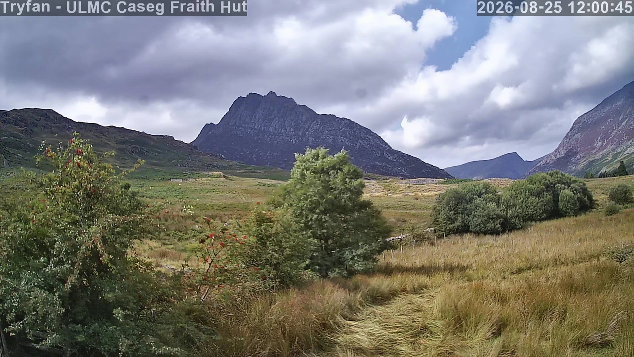
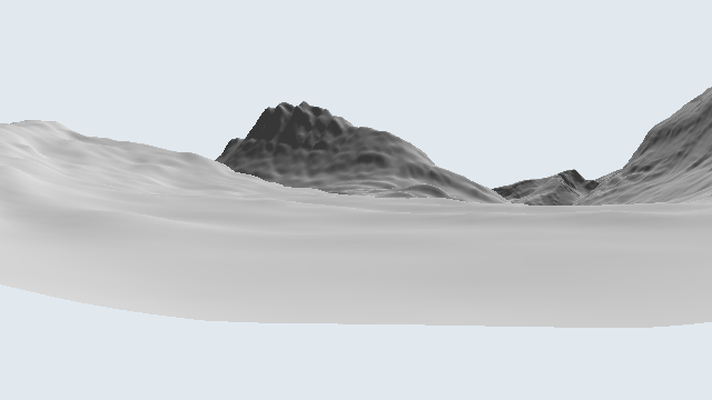
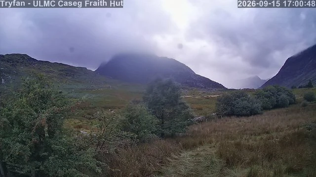
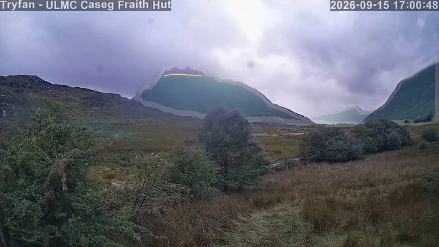
Selected examples to explain the process, not an accuracy test or current conditions. Photographs are resized for display; analysis overlays are added by Mountain Weather. All heights remain provisional until independently checked.
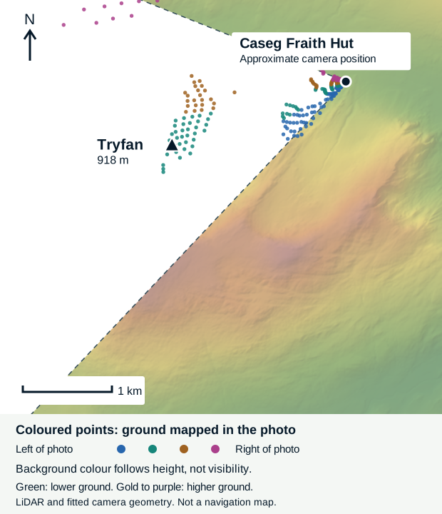
With thanks to University of London Graduate Mountaineering Club (ULGMC), Caseg Fraith Hut, photographs used with permission. Terrain: Welsh Government / Natural Resources Wales LiDAR, Open Government Licence v3.0.
Explore a day
All available height readings for Tryfan. Times follow the UK clock; heights are above sea level.
47 readings on 16 September 2026, so far today.
| Time | Cloud base | Cloud edge |
|---|---|---|
| Above visible tops | Above visible tops | |
| Above visible tops | Above visible tops | |
| Above visible tops | Above visible tops | |
| Above visible tops | Above visible tops | |
| Above visible tops | Above visible tops | |
| Above visible tops | Above visible tops | |
| Above visible tops | Above visible tops | |
| Above visible tops | Above visible tops | |
| Above visible tops | Above visible tops | |
| Above visible tops | Above visible tops | |
| Above visible tops | Above visible tops | |
| Above visible tops | Above visible tops | |
| Above visible tops | Above visible tops | |
| Above visible tops | Above visible tops | |
| Above visible tops | Above visible tops | |
| Above visible tops | Above visible tops | |
| Above visible tops | Above visible tops | |
| Around 800 m | Very diffuse | |
| Around 850 m | Not assessed | |
| Around 850 m | Not assessed | |
| Around 800 m | Sharp | |
| Around 800 m | Very diffuse | |
| Around 750 m | Sharp | |
| Around 800 m | Sharp | |
| Around 800 m | Sharp | |
| Not measurable | Not assessed | |
| Above visible tops | Above visible tops | |
| Around 800 m | Sharp | |
| Around 800 m | Sharp | |
| Around 800 m | Sharp | |
| Around 800 m | Sharp | |
| Around 800 m | Very diffuse | |
| Around 750 m | Sharp | |
| Around 750 m | Sharp | |
| Around 700 m | Sharp | |
| Around 600 m | Soft | |
| Around 600 m | Soft | |
| Around 650 m | Very diffuse | |
| Around 550 m | Very diffuse | |
| Around 650 m | Sharp | |
| Around 650 m | Soft | |
| Around 600 m | Very diffuse | |
| Around 650 m | Sharp | |
| Around 650 m | Sharp | |
| Around 600 m | Soft | |
| Around 650 m | Very diffuse | |
| Around 700 m | Sharp |
A sharp edge is easier to locate; a soft or diffuse edge is less distinct. Above visible tops means the mapped slopes appear clear, but the camera may not resolve the summit itself. Haze, mist, rain on the lens and changing light can all complicate the view. No estimate means no usable height, not a clear sky. Downloads keep missing values empty and include any available mist and confidence flags. They contain all retained readings for the day, not a guarantee of continuous coverage.
Use these observations
Checking a hill day, comparing a forecast or building a tool for walkers? Download the daily readings as CSV or JSON. Please credit Mountain Weather and the camera provider, link back here, and keep the observation time and quality flags with the height.
Decimal values in a download are model output, not a claim of metre-level accuracy. These are image-derived estimates, not instrument measurements. Camera photographs have their own licences and permissions; a data download does not grant rights to republish them.